Project Phases
At a Glance
Phases 1 and 2 of the Carolina Crossroads Project are expected to be substantially complete in 2025. Phases 3A and 3B will continue into 2026. Phase 3C is in pre-construction.
Learn more about each phase below and view the final design layout.
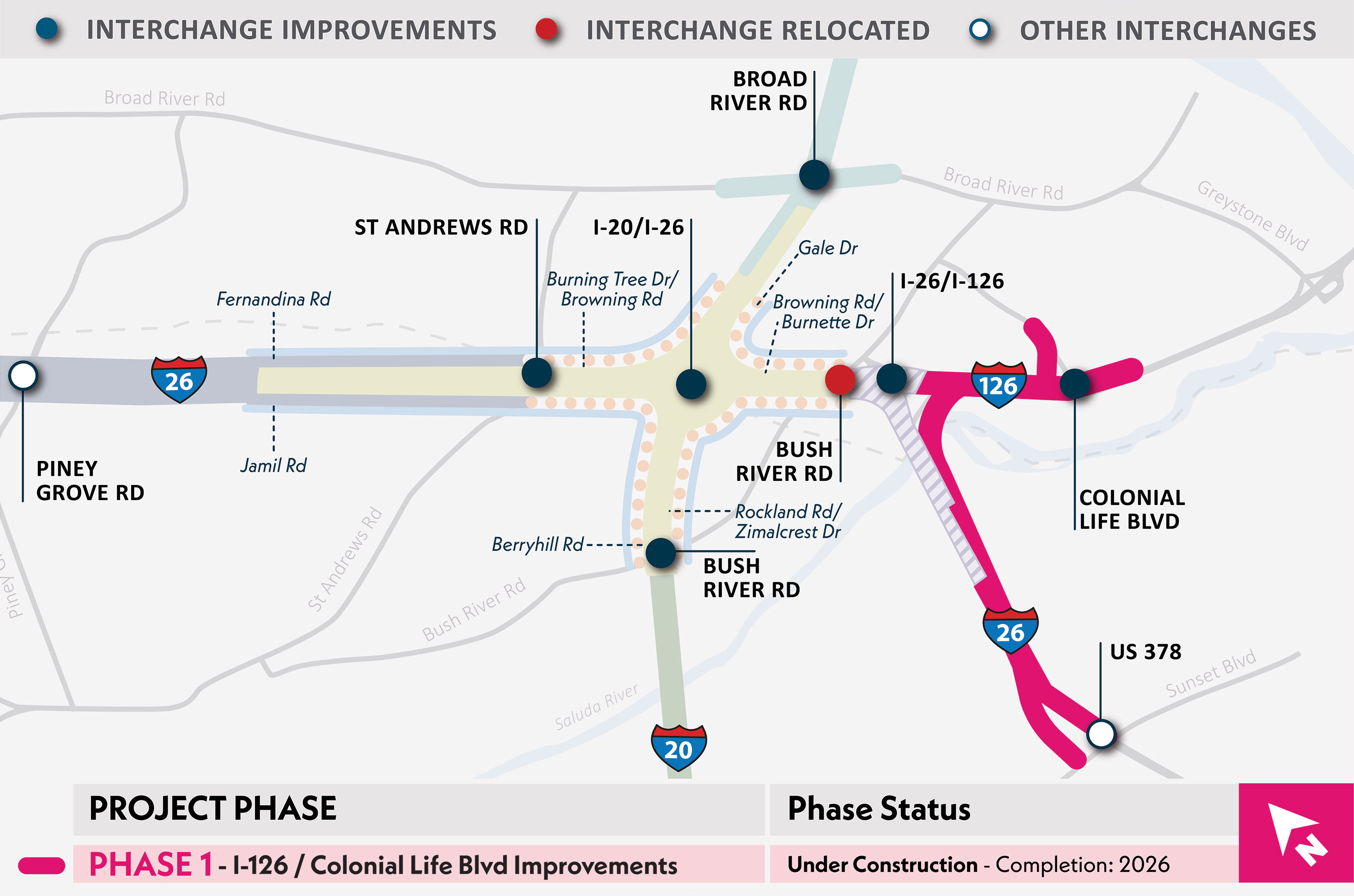
Overview and Activities
- Created a new full access interchange at I-126 and Colonial Life Boulevard.
- Removed the Bush River Road interchange at I-26.
- Lengthened the I-26 eastbound exit ramp to US 378/Sunset Boulevard.
Benefits
- Improves traffic flow and safety by limiting weaving actions needed to access I-26 westbound and I-26 eastbound between I-20 and I-126.
- Provides ramps and mainline improvements to meet current design standards including minimum curve radii, shoulder widths, acceleration and deceleration lane lengths.
- Provides adequate storage for queues (backup) at Exit 110 off-ramp so that mainline I-26 lanes are not blocked.
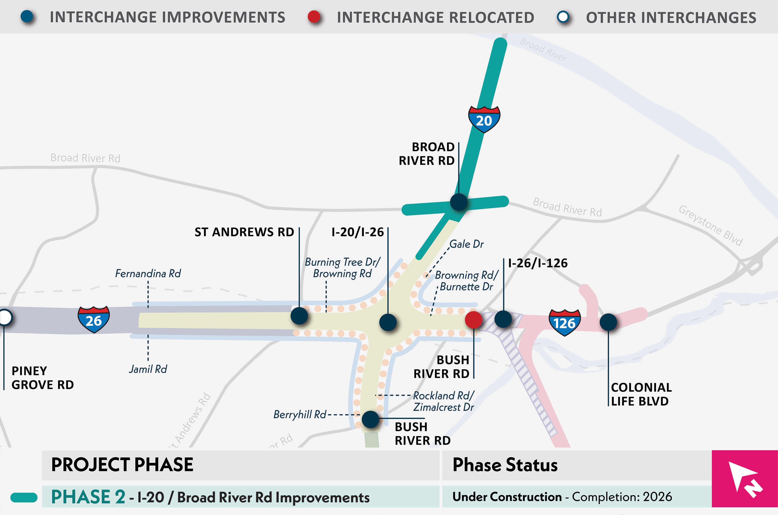
Overview and Activities
- Improved the Broad River Road interchange at I-20.
- Removed the shared ramp with Garner Lane.
- Widening of I-20 and prepare for additional improvements in later phases.
Benefits
- Makes it easier for drivers to access I-20.
- Removes the shared ramp with Garner Lane to simplify interstate ramp and reduce conflict points.
- Provides adequate storage for queues (backup) from the I-20 westbound to I-26 westbound ramp so that mainline I-20 lanes are not blocked.
Timeline
- Work will be completed in 2025.
Work Hours
- Most of the work is being conducted during daytime hours.
- Work is being completed in segments allowing new lanes to be opened in phases.
- Nighttime or off-peak lane closures are being utilized.
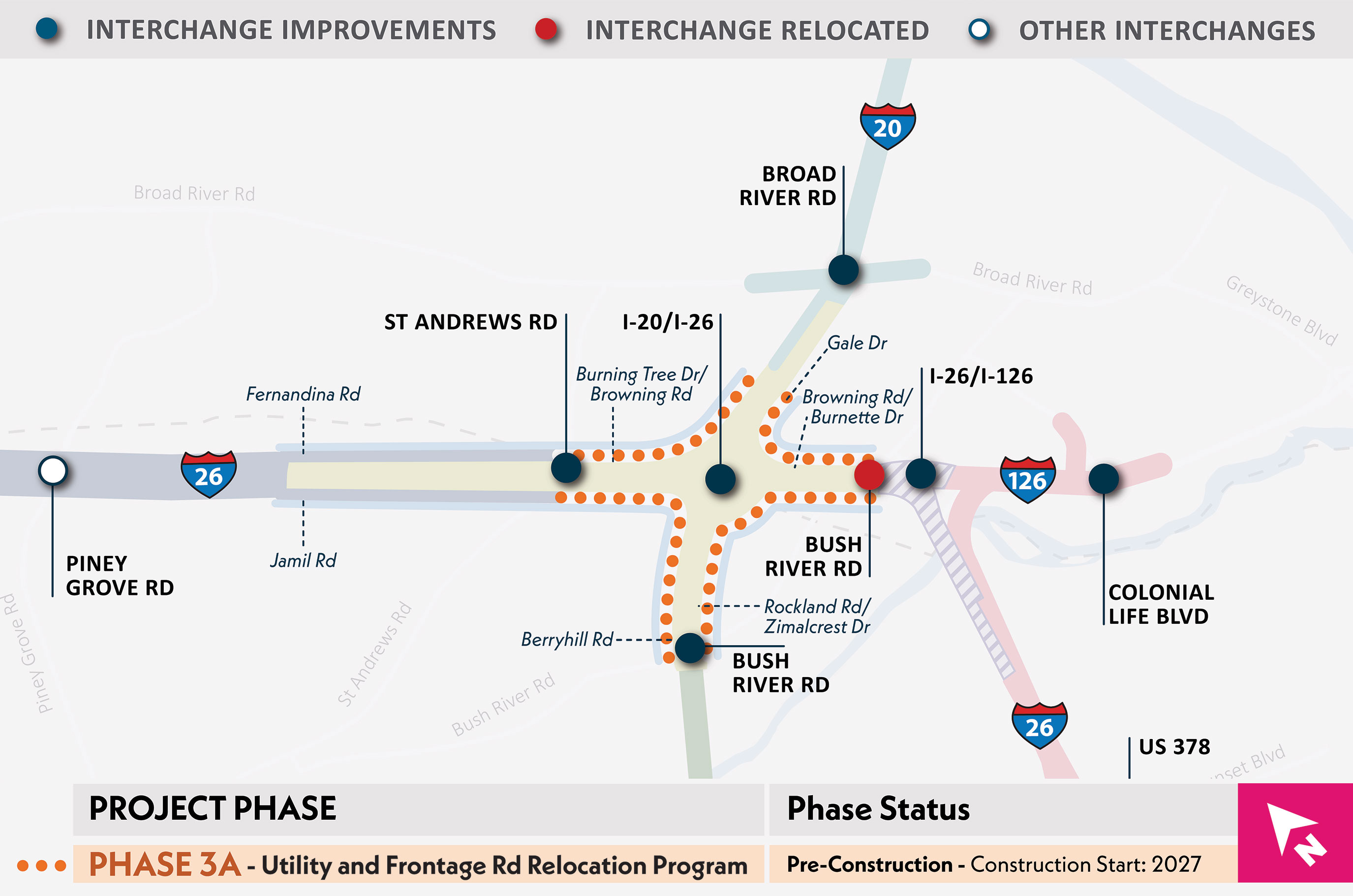
Overview and Activities
- Utilities and frontage road relocations.
Benefits
- Prepares project area for interstate and interchange improvements.
- Isolates timely third-party utility relocations from interstate work and reduces project risks.
Timeline
- Utility coordination work began in 2024, and the frontage road relocations are scheduled to begin in 2026.
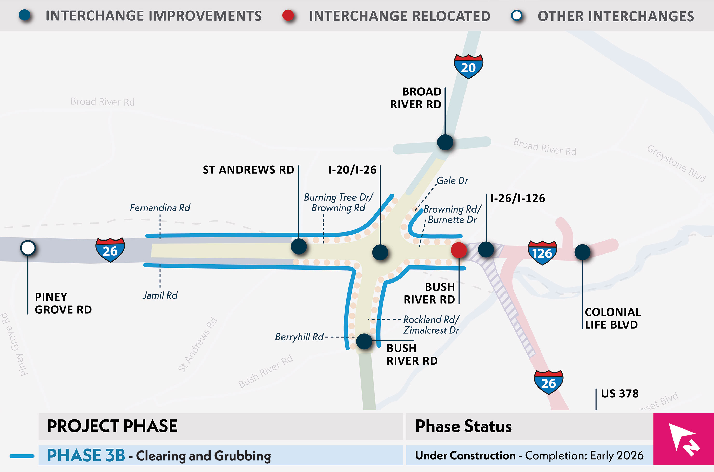
Overview and Activities
- Clearing and grubbing approximately 170 acres across the I-20/I-26, St. Andrews Road/I-26, and Bush River Road/I-20 interchanges.
Benefits
- Allows for the advancement of critical utility relocations for upcoming phases within the I-20 and I-26 interchange area.
- Enhances safety and visibility for drivers.
Timeline
- Work is underway and is anticipated to end in 2026.
Work Hours
- Majority of the work will take place during daytime hours (9 am - 5 pm).
- Occasional temporary lane closures may occur during nighttime operations.
- Daily traffic control will occur on the frontage roads during work in proximity to frontage roads. Flaggers will be used to create single lane roads.
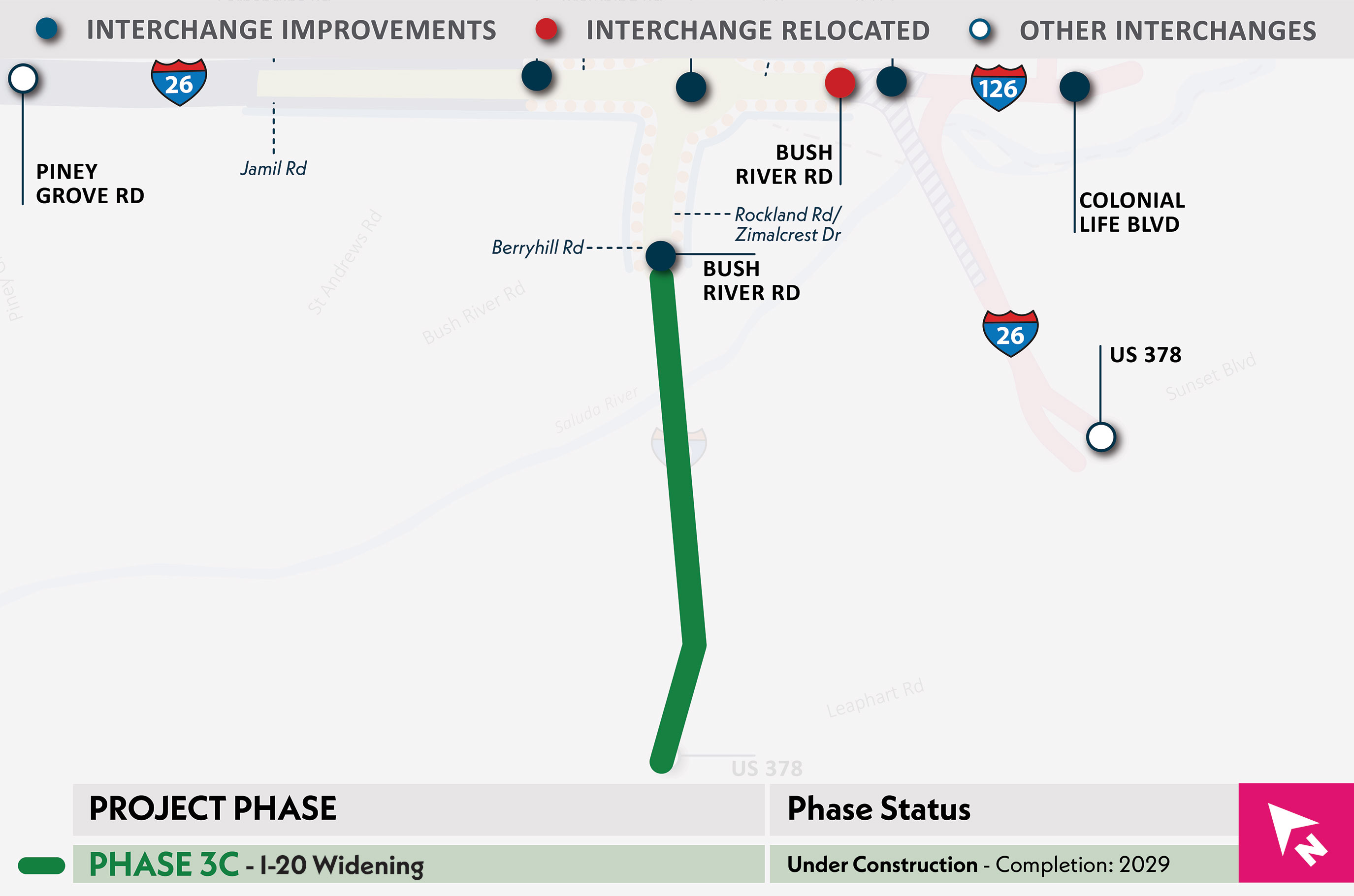
Overview and Activities
- Replacement of the I-20 bridges over Saluda River and CSX railroad.
- Widening I-20 to accommodate future lane additions in later phases.
- Does not include replacement of Bush River Road at I-20 interchange.
Benefits
- Prepares project area to tie-in with future phases.
- Provides bridges that meet current design standards.
Timeline
- Construction has begun and is anticipated to be completed in 2029.
Overview and Activities
- Replacement of I-26 bridges over the Saluda River and CSX railroad.
- Replacement of the I-126 westbound to the I-26 eastbound bridge.
- Widening of I-26 to accommodate lane additions in future phases.
- Construction of an I-26 bridge over realigned I-126.
- Extension of the I-26 westbound collector-distributor road.
Benefits
- Provides bridges that meet current design standards.
Timeline
- Construction is anticipated to begin in 2027.
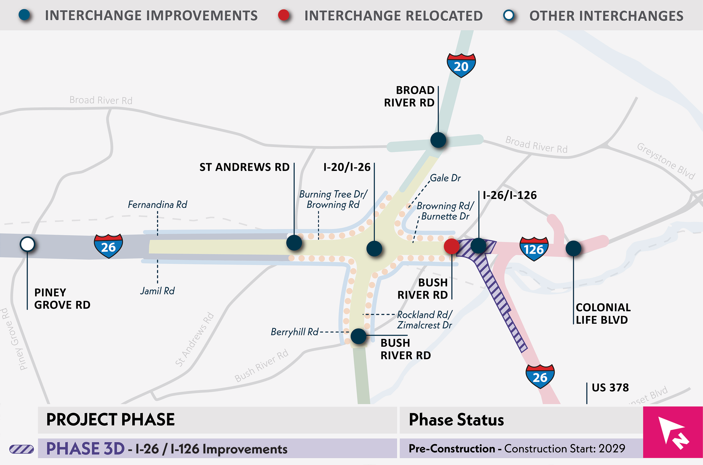
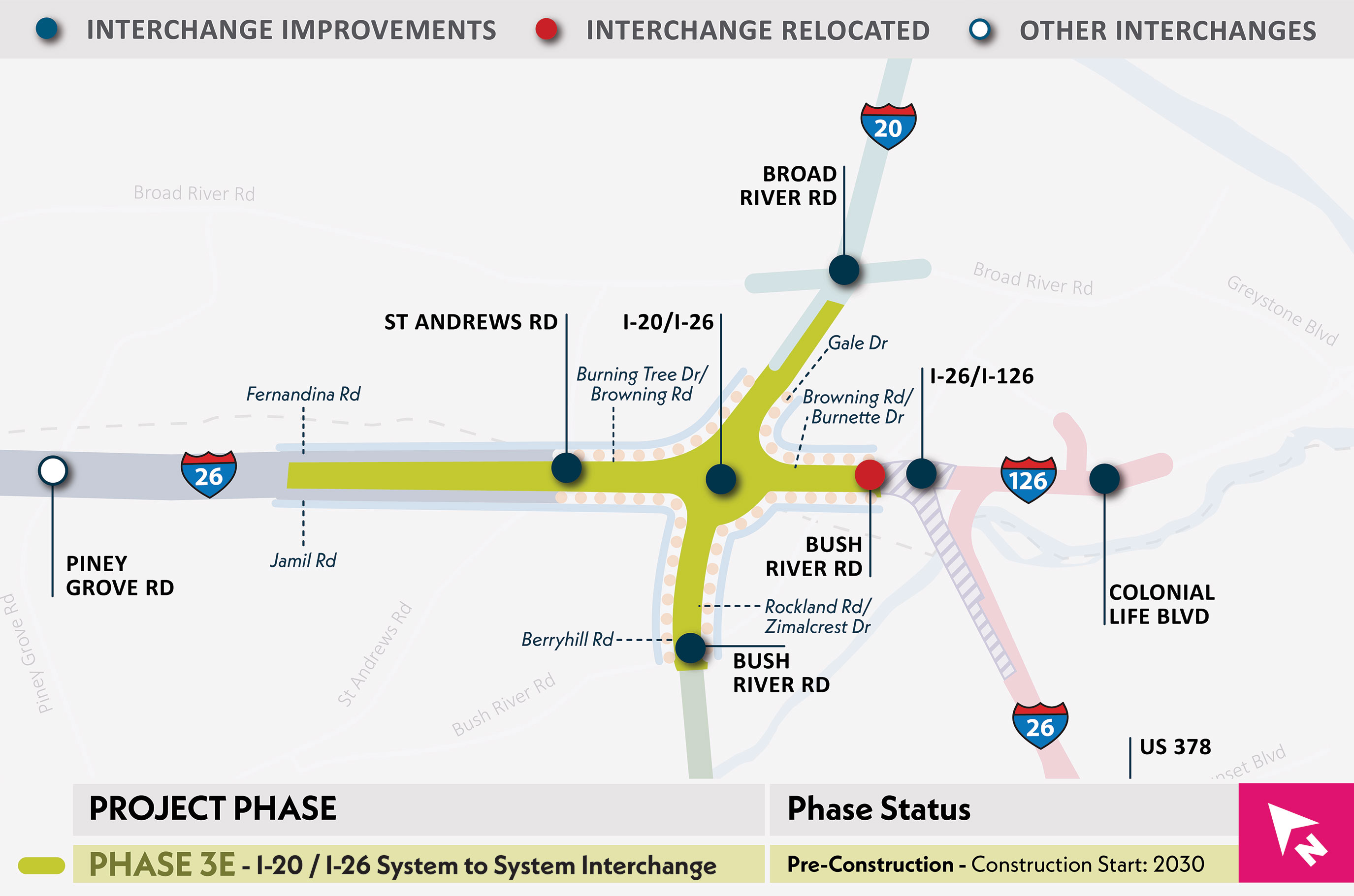
Overview and Activities
- Reconstruct the I-20/I-26 interchange.
- Complete widening of I-20 between Phases 2 and 3C.
- Complete widening of I-26 between Phases 4&5 and Phase 3D.
- Reconstruct St. Andrews Road at the I-26 interchange.
- Reconstruct Bush River Road at the I-20 interchange.
Benefits
- Rebuilding the I-20/I-26 interchange to limit the weaving actions needed to access I-20 and I-26 mainlines, improve operations, increase capacity, and improve safety.
- Improvements to St. Andrews Road at I-26 and Bush River Road at I-20 will improve operations, increase capacity, and improve safety for drivers and pedestrians.
- Improvements will bring the corridor up to current design standards.
Timeline
- Construction is anticipated to begin in 2030.
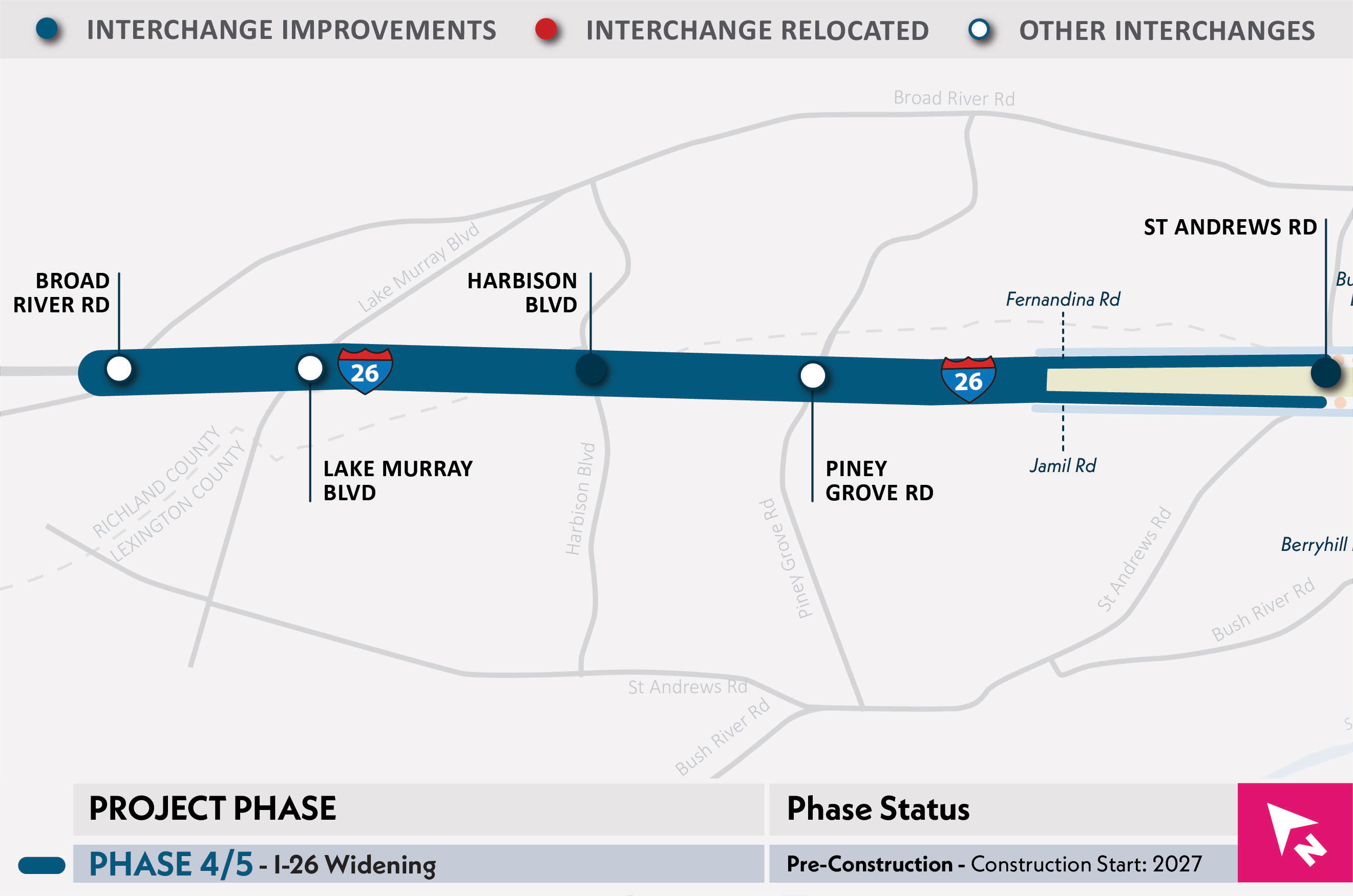
Overview and Activities
- Reconstruction of the I-26/Harbison Boulevard interchange.
- Widening of I-26 east of Piney Grove Road to west of Exit 101.
- Relocation of frontage roads and utilities.
Benefits
- Rebuilding the I-26/Harbison Boulevard interchange will increase capacity, improve operations and safety.
- Widening I-26 will increase capacity, improve operations and safety.
- Relocating frontage roads and utilities to support roadway improvements.
Timeline
- Construction is anticipated to begin in 2027.